Wednesday, April 18, 2012

Star Trek movies and Beethoven symphonies

Beethoven symphonies and Star Trek movies follow similar (although complementary) patterns.

Odd-numbered Beethoven symphonies are the best loved.

Single important even-numbered exception: Beethoven 6, the "Pastoral" symphony, is perhaps the first example of Romantic-era programmatic music.

Runt of the litter (weakest odd-numbered symphony): Beethoven 1 is not nearly as well-loved as 3 ("Eroica"), 5, 7, or 9 ("Choral").

SymphonyYear of
Premiere
YouTube views*
 (thousands)
11801239
21802217
3 "Eroica"18051,292
41807 281
518083,915
6 "Pastoral"1808873
718132,769
81814265
9 "Choral"18244,426

*Table of YouTube views as an indicator of popularity from Classical Convert: Ranking Beethoven.

Even-numbered Star Trek movies are good. This pattern holds through the numbered films with the original cast as well as the films with the cast from The Next Generation.

Single important odd-numbered exception: Star Trek III: The Search For Spock provides essential aspects of the Star Trek II-III-IV story arc. Also: seeing Christopher Lloyd (Back to the Future's Doc Brown) as a Klingon was pretty sweet.

Runt of the litter (weakest even-numbered film): Star Trek: Nemesis, the tenth movie of the franchise.

TitleRelease
Year
Tomatometer rating*
1Star Trek: The Motion Picture197947%
2Star Trek II: The Wrath of Khan198290%
3Star Trek III: The Search for Spock198477%
4Star Trek IV: The Voyage Home198684%
5Star Trek V: The Final Frontier198921%
6Star Trek VI: The Undiscovered Country199183%
7Star Trek: Generations199448%
8Star Trek: First Contact199692%
9Star Trek: Insurrection199856%
10Star Trek: Nemesis200238%

* Tomatometer rating from Rotten Tomatoes.  What is the Tomatometer?

Related:

http://www.yourmusicmarket.com/beethoven-symphonies/


Tuesday, February 14, 2012

Summer of ground squirrels

By all accounts, the summer of 2010 was a good one (though I waited until January 2012 to finish writing about it). My favorite count, though, is the number of species of ground squirrels I saw this summer: at least seven. I had the good fortune to travel to a number of places with new and different non-arboreal scurids this summer.

Why bother studying ground squirrels? The best reason is that they're adorable. The second-best reason is that their numbers and habits make them among the most readily observed mammals in North America. I could spend my whole vacation in a blind waiting for a monkey-faced disco hawk or some other rare bird or mammal to come into view for a few seconds, or I could take a short walk along a talus pile on a sunny day and see who pops up. I took all the pictures below with my Canon Powershot SX110 IS, a nice but not terribly expensive point-and-shoot with a 10x optical zoom.


1. California ground squirrel, Otospermophilus beecheyi
Lisa and I saw this little fella, formerly known as Spermophilus b., on a bay-front walking path in Alameda, California.


2. Golden-mantled ground squirrel, Callospermophilus lateralis
This handsome rodent, formerly called Spermophilus l., superficially resembles a chipmunk, but is distinct in that chipmunks' stripes extend onto the face. This guy was scampering among the rocks at a Donner Pass Road overlook in Nevada County, California, near the famous Donner Summit Bridge. The American Society of Mammologists species account describes its running gait as "clumsy" (ASM Report #440, Spermophilus lateralis, 1993), which seems unnecessarily harsh. Perhaps the authors had observed only pubescent ground squirrels going through that awkward phase - want to make fun of their cracking voices and acne, too? Not cool, mammologists.

We also saw a yellow-bellied marmot there; my mother-in-law almost ran it over (unintentionally), but he safely scampered away.


3. Belding's ground squirrel, Urocitellus beldingi
Despite appearances, this guy is not a prairie dog. Formerly known as Spermophilus b. (noticing a pattern here?), this squirrel hangs out in alpine meadows. His habit of standing bolt upright to watch for danger led early settlers to call him the "picket pin". There was a small colony of these guys in the summit resort area at Squaw Peak.

4. Yellow-bellied marmot, Marmota flaviventris
Mr. Chubby-Cheeks here was seen hiding in a landscaped rockpile next to the hot tub at the Squaw Valley summit resort area. Lisa pointed out that some of the teenagers in and around the hot tub probably thought I was being creepy, hanging around with a camera in hand. I don't care - this picture was worth it. Click to enlarge it - you can see the marmot's nose hairs!

5. Chipmunk, Tamias sp.
This handsome rodent was spotted on a talus pile at a Lake Tahoe overlook and could be one of three species:
Tamias amoenus - Yellow-pine Chipmunk
Tamias speciosus - Lodgepole chipmunk
Tamias quadrimaculatus - Long-eared Chipmunk


6. Thirteen-lined ground squirrel, Ictidomys tridecemlineatus
This many-striped ground squirrel was known as Spermophilus t. prior to taxonomic revision. Lisa and I saw this individual feeding on some spilled popcorn on the central mall at Brookfield Zoo, in the Chicago suburbs. Nothing like a good stretch while eating unpopped kernels of salty goodness, eh?


7. Woodchuck, Marmota monax
I saw this chunky 'chuck at a family friend's place in Waukesha County, Wisconsin, on Labor Day. I think he safely sneaks under the radar as the last official ground squirrel of the summer. In some parts of the country, it's socially acceptable to call this animal a "whistle-pig", which is awesome.


View Summer of Ground Squirrels in a larger map


My identifications were assisted by:
  • Squirrels of the West. by Tamara Hartson (Lone Pine Publishing, 1999). I stumbled across this book in a Forest Service visitor center and instantly knew I had struck gold. I also recently acquired Squirrels of North America by Tamara Eder, who apparently is the same person.
  • San Francisco State University - Sierra Nevada Field Campus species list
  • National Audubon Society Pocket Guide - Familiar Mammals of North America
  • American Society of Mammologists species accounts (#221, #440, and others); some of them are freely available

Wednesday, August 10, 2011

BWCA 2011: Day 3


Boundary Waters Adventure with Lisa, Eric Z., Jessica H., and Kate S.

August 8-12, 2011


Day 3 - Back to Day 2 - On to Day 4

By dawn Lac La Croix had calmed from whitecaps to millpond. We had breakfast on the rocky point by the campsite and broke camp. We were sad to leave the site, but we could not in good conscience ask our hosts to share their site with us another night, so it was time to set sail in search of a new home.
Sunrise on Lac La Croix

Breakfast on the point
The first order of business was to find a campsite. We found an open site further north on Lac La Croix. It looked perfectly serviceable, but since it was before noon, we decided to look for another site, one that would be on a point more exposed to wind, such that it would keep the mosquitoes down. We posted Eric and Lisa with one canoe and a few bags as guards at the first site, and Kate, Jess, and I grabbed some other gear and went to check out the alternate site. We found the alternate site guarded by turtles but otherwise unoccupied. We set up some a tent to call dibs on the alternate site and went back to the first to give Eric and Lisa the good news.
Turtles guard the entrance to the bay on which we camped
With our new home established, we grabbed the day bags and went out looking for adventure. There are several well known sets of pictographs on a cliff face on the Canadian side of Lac La Croix. We spent a long time admiring them from the water, and then stopped to to have a snack.

Approaching the pictographs on Lac La Croix
We happened to encounter our Tuesday night campsite hosts at the pictographs. They graciously took a picture of all of us, and conscientiously returned the air mattress repair cement that Jess had lent them. We made a leisurely return to our campsite. I fished a bit (unsuccessfully) but saw a cool frog.


Some members of the party found other forms of amusement.


Then there was dinner, listening to loons, and bed.

Evening on the bay

Back to Day 2 - On to Day 4 

Tuesday, August 9, 2011

BWCA 2011: Day 2

Boundary Waters Adventure with Lisa, Eric Z., Jessica H., and Kate S.
August 8-12, 2011


Day 2 - Back to Day 1 - On to Day 3


I woke up just after dawn, watched the sunrise, and fished a bit.


Sunrise on Lake Agnes
Then I went back to sleep for about two hours.


When I got up - for realsies this time - the rest of the crew was having breakfast.


As I was taking down our tent, out of view of the lake, I heard a yelp and a splash. I ran to investigate and found Lisa, fully dressed in her jacket and rain gear, in the water on her hands and knees. She had been trying to rinse off her camp shoes when she slid down the rock into the water.I was tremendously relieved when I saw her stand and I knew she wasn't hurt, but my heart sank when she tried to stand and walk back to shore only to slip and splash again - the rock shelf that extended from our campsite into the water was just too slippery. Finally, Jess, Kate, Eric, and I formed a human chain extending from an area we could get a solid footing down into the water, and with a fallen branch to provide extra reach, we gave Lisa a solid handhold and she was able to make it to shore. Her arms and legs were soaked, but, critically, the core of her body was dry, and she decided a change of clothes would be unnecessary. Even more importantly, she was still smiling. Soon we were underway, heading north to Lac La Croix, along the Canadian border. 


On Day One, Lisa and I were in one canoe and Eric, Jess, and Kate were in the other (the middle person in the three-person canoe did not paddle). For the sake of variety, and to share time in the non-paddling seat, we rearranged seating for Day Two: Eric and I were in one canoe, and Lisa, Kate, and Jess were in the other.


My journal entry for the day begins:
Awoke Tues am on L. Agnes. Broke camp in intermittent light shower. Paddled north to Boulder R., at north end of L. Agnes. Paddled/poled thru rocky section marked as "rapids" on Fisher map. No rapids per se, just big rocks with narrow channel between. Then two portages (23 rod and 69 rod) into Boulder Bay on Lac La Croix. Capsized the canoe while putting into Boulder Bay. All main packs fine - they floated - but day pack got wet. NOAA weather radio inoperable. Emptied canoe, repacked, and paddled across bay to an empty campsite to use the "biffy".
Rapids along Boulder River. I never get tired of scenes of water flowing over rocks.
Eric and I shook off the embarrassment of capsizing the canoe - in full view of the ladies! - while loading it. I was pretty peeved that the weather radio got dunked, but I had no one but myself to blame - inexplicably, I had stuffed it into a very non-waterproof day pack rather than a dry bag that morning. I should have taken it apart immediately to allow all the water to escape, but I didn't do so until we made camp that afternoon. 


As we paddled out of Boulder Bay, it started to rain off and on. I think everyone's extremities were wet by this point, so we didn't mind too much. Critically, everyone's core was dry; otherwise, we would have stopped immediately. Still, I was really, really happy that, on a whim, I had decided to treat myself to a pair of neoprene paddling gloves when we made our last stop at the gear shop in Ely.


As we turned the bows of our canoes back toward Lac La Croix, the wind picked up. My journal entry continues: 
North wind – which had been blowing all day – got stronger. Also rained on and off. Paddled along west edge of peninsula separating Boulder Bay from Tiger Bay, straight into the wind. Then turned east to cross to a campsite on a boomerang-shaped island we had heard was good. Waves hitting beam of canoe made for unpleasant ride. As we approached, saw that the site was apparently occupied by just one man with no gear. Waited a moment to see if he showed any signs of leaving, but we couldn’t linger as lake was getting rougher. Decided to cross channel to another island with sites at N and S ends. As we approached, saw that this other site was also occupied. North wind stronger and lake rougher, so beached on sandy beach just N of second site – out of wind in cove – to regroup.
After resting a moment, we decided to paddle into the lee of the island we had landed upon and check another potential campsite (in the BWCA, camping is permitted only in designated sites with a Forest Service pit toilet and fire ring). When we rounded the southern tip of the island, we saw another party waiting out the wind in the lee, and shortly thereafter we found the hoped-for campsite occupied. We decided to cross the open channel back to the boomerang-shaped island and look for a campsite in that area. 
Paddled back to S tip of island with intention of making a break to easternmost end of boomerang-shaped island. Crossing very rough. I steered one canoe (Eric in front), Kate steered the other (Jess in front, Lisa in middle). North wind now very strong and lake very rough. Taking waves on beam could have swamped or even capsized a canoe. Decided to paddle straight into wind and waves for a bit, then turn sharply to go south toward boomerang island with quartering/following waves. Used lots of rudder to keep canoe from being turned parallel to the waves. Took on water splashing over bow when moving upwind. Finally reached lee of boomerang-shaped island, a little rattled by the crossing. 
At this point I became convinced that Boreas, the North Wind, was out to get us personally. Perhaps the Her Majesty's government had summoned the wind to keep us away from Canadian territory on the other side of the lake.
Decided to go talk to the lone dude on point of the boomerang-shaped island to see what his plans were. Sent Jess to hike around island to be our diplomat. Too rough to leave lee of island in canoes without good cause. Jess returned some time later with the news that the site was occupied by a father and son that had set up base camp there and were planning to stay a few days, but that they would share the site with us if we could find no other – "come back if you can’t find anything else," they said. This would be ok per BWCA regs since there would be only seven people and three canoes all together [in the BWCA, a maximum of nine people and four canoes may travel or camp together]. Decided to check a few other sites. Decided to send Kate & Jess to check two sites on bigger island to E, since that area was mostly out of the wind. The returned within three minutes, so we immediately knew the sites were occupied. In fact there were so informed by a passing canoe so they didn’t bother to check.  With this news, and the wind strong as ever, we decided to prevail upon the kindness of the duo on the boomerang-shaped island. We lined/walked the canoes around the windward side of the island. 
Walking the canoe into camp

Once we had introduced ourselves to the father and son and thanked them for accommodating us, we set up tents and clotheslines and set our wet gear out to dry. 


Boreas, the North Wind, toyed with us while looking for a campsite on Lac La Croix. We walked/lined the canoes from east to west on the north shore of the boomerang-shaped island.


The clouds broke up and the sun warmed our faces and, with the still-strong wind, quickly dried our gear. We filtered water, had some snacks, and gradually discovered that we occupied what was probably the most beautiful campsite on the lake.

Looking north from our campsite toward evening

We discovered that, as a teenager, the father had gone on a Boundary Waters trip with the same summer camp that Kate had attended and later guided for. He also mentioned that before the previous evening's rain, the fly-fishing action for smallmouth bass on Lac La Croix had been outstanding. I had quit fishing on Lake Agnes earlier on that evening and, if the theories of the influence of barometric pressure on fish behavior are to be believed, missed the bite: Micropterus dolomieu 1, me 0. But as we watched the sun set and the stars appear over the rocky point at the edge of our campsite, I didn't mind too much.


Sunset on Lac La Croix
Back to Day 1 - On to Day 3 

Monday, August 8, 2011

BWCA 2011: Day 1

Boundary Waters Adventure with Eric Z., Jessica H., and Kate S.
August 8-12, 2011
Following last year's adventure, Lisa joined the crew for another Boundary Waters trip. We began our Minnesota adventure with a quick visit with Lisa's parents and friends in the Twin Cities. The trip started auspiciously with a meal at the world 's largest Culver's restaurant, in Edgerton, Wisconsin.


While Lisa and I were heading north from the Cities, Eric and Jess were passing through Duluth, where they made another pilgrimage to the Duluth Pack store and caught a view of the famous Aerial Bridge opening to accommodate an ore boat entering the harbor.

We all converged on Ely around dinnertime, meeting up with Kate who was already in town. We enjoyed a pre-trip feast and then got down to a frenzy of packing.


Day 1 - on to Day 2


We left Ely about 9:15 am and headed northwest on Echo Trail to BWCA Entry Point #16, Moose River North. The entry parking lot was packed, and a few small groups were entering and leaving the BWCA as we readied our gear.

It was a 160 rod (half-mile) portage from the parking area to the put-in. The weather was partly sunny and about 75 degrees. There was a sandy beach area at the put-in, nice for loading canoes. Just upstream (south) of the put-in, the river flowed through a rocky stretch. During high water, this was probably a rapids or small falls; in August, it was mostly rocks with a small stream gently flowing through. From the put-in north, we found the Moose River to be a slow-moving stream through a swampy lowland. The tannin-stained water was bordered by willows and other low brush.


The Moose River put-in

Downstream from the put-in, the Moose River was punctuated by a few small rapids and one old, very large beaver dam. We made short work of the 20 and 25 rod portages around these obstructions. Further downstream, we encountered two more beaver dams. We simply dragged the canoes over these. A third dam had been breached by flood or other activity, allowing us to paddle straight through. The Moose River emptied into Nina Moose Lake, and we paddled straight across Nina Moose Lake to its outlet, the Nina Moose River. We stopped for lunch at a small sand beach just west of the outlet. As we were crossing Nina Moose Lake, a south wind picked up. Maneuvering the canoes in the following waves got to be a little tricky.


Lunchtime on Nina Moose Lake


After lunch, we proceeded north along the Nina Moose River. Two small rapids - really just rocks, with very little water trickling among them - interrupted our paddling with 70 and 96 rod portages, respectively. We also dragged our canoes over another beaver dam. We saw a whitetail deer in the brush, a bit back from the water. This was to be the only large mammal we saw on the trip. The Nina Moose River seemed to go on for a long, long time. We had to push or pole the canoes through several shallow reaches. Finally, we reached Lake Agnes, where we planned to spend the night.


We grabbed the first open campsite on Lake Agnes, at the southwest end of the lake, just north of the mouth of the Nina Moose River. We had heard distant rumblings of thunder, so we set up camp quickly. The storm never passed near us, but we were treated to a rainbow over the north end of the lake anyway. We also discovered that some previous occupant of the campsite had assembled a rock windscreen around the Forest Service fire grate and fashioned a table out of some fairly substantial rocks. "Improvements" such as these are officially discouraged by the Forest Service; while we wouldn't build improvements ourselves, we had no qualms about taking advantage of someone else's handiwork.


Campsite on Lake Agnes


While setting up the tents on a grassy patch set back from the lake and our cooking area, we noticed that our footfalls made an odd hollow sound. We stomped around for a while and became convinced that the possible void beneath us posed no threat. Sure enough, we would sleep soundly atop this geological oddity.

We spent the remaining hours of daylight preparing dinner and defending it from the local ground squirrels. In keeping with tradition, our first evening's meal was the steaks that had been thawing in our food pack while we were paddling. Fry bread rounded out the meal.

First night's dinner: steak and fry bread

Toward evening, I made a few casts with the Scum Frog Tiny Toad. I fish with surface lures - floating plugs, poppers, sliders, dry flies - whenever possible, and it seemed to make sense to do my initial prospecting with a weedless floating lure, but I didn't get any strikes. Finally, just after sunset, we went to bed.


On to Day 2

Thursday, February 3, 2011

45 N, 90 W

GPS dorks (e.g., yours truly) think it's cool to visit points on the surface of the earth where imaginary lines of latitude and longitude intersect. These points are called "confluences" to make them sound more awesome.

It should be noted that latitudes are a lot less arbitrary than longitude: the latitude of a given point corresponds directly to the elevation angle of the North Star above the horizon at that point; the locus of points at which this elevation is a given number is a circle around the earth.

That's why crossing the 45th parallel is neat- you're halfway between the Equator and the North Pole. Of course, if you started from 42°N, as I did, it's less exciting. However, during the summer, those three degrees of latitude mean noticeably more daylight. This is important for one of two reasons: 1) like a reptile, I need to bask; or 2) like Kal-El, the last son of Krypton, I gain my powers from the Earth's yellow sun. Believe whichever of those you like.

I'm not the only one who thinks this is cool. The park district of Marathon County, Wisconsin, put up a sign on the confluence of 45°N and 90°W. According to the writeup at RoadsideAmerica.com, the very existence of this monument is the culmination of one man's personal quest.


It's worth noting that the marker was probably placed without benefit of GPS. Geographic nerdosity existed long before (artificial) satellites could tell us anything useful. GPS just helped. A lot.

Coordinates: (surprise!) 45°N, 90°W. There's a signed access road from Highway 29.


I visited the site and took this picture over five years ago. The current winter wonderland reminded me of stomping around in the snow to find the marker.

Saturday, November 20, 2010

Sleepy badger


Look at him, he's probably dreaming about mauling prairie dogs.

Sleep well, my ill-tempered friend.

Seen a while ago at the NEW Zoo, near Green Bay, Wisconsin.

Terrible ideas

I'm looking for an artist to flesh out my concept for a children's show. It's a carnivorous South American catfish with a never-say-die attitude: The Can-Do Candirú!

Likewise, I want to write and illustrate a children's book on animal tracks and signs. It will be called Which Species Made These Feces?

I have a business plan for a drive-thru restaurant for vultures: The Carrion Carry-Out.

I want to print bumper stickers with this slogan: Fortune Favors The Bold, But Inertia Favors The Lazy.

Sunday, November 14, 2010

Bears and minivans: a love story

Bears love minivans. I stumbled across a recent (2009) paper in the Journal of Mammalogy which demonstrates this scientific fact:
ABSTRACT: Black bears (Ursus americanus) forage selectively in natural environments. To determine if bears also forage selectively for anthropogenic resources we analyzed data on vehicles broken into by bears from Yosemite National Park, California. We classified vehicles into 9 categories based on their make and model and collected data on use (2001–2007) and availability (2004–2005). From 2001 to 2007 bears broke into 908 vehicles at the following rates: minivan (26.0%), sport–utility vehicle (22.5%), small car (17.1%), sedan (13.7%), truck (11.9%), van (4.2%), sports car (1.7%), coupe (1.7%), and station wagon (1.4%). Only use of minivans (29%) during 2004–2005 was significantly higher than expected (7%). We discuss several competing hypotheses about why bears selected minivans.
Basically, the authors looked at the National Park Service database of bear vehicle break-ins in Yosemite Valley from 2001 to 2007 and broke down the data by the bruins' choice of vehicle type for each nocturnal breaking-and-entering session. Even though minivans represented only 7% of the vehicles parked overnight in Yosemite Valley, an astounding 28% of all ursine vehicular incursions were directed against minivans.

Read the article for yourself (not sure how long this link will persist.)

Why do bears love minivans so much? Is it the comfortable bucket seats, the generous cargo area, the convenient sliding doors, the "not great but really pretty ok for a big car" gas mileage? It is well known that bears enjoy all things automotive: outside Denver, a bear broke into a car, put it in gear, and crashed it into a tree. The car was a total loss. Back to minivans, though, it turns out that the convenient sliding doors and adjustable seats are part of the allure. One of the authors was quoted in a San Francisco Chronicle article on the study as saying that bears pry open the doors, tear out back seats, and pop open windows (rear side windows are apparently their favorite entry route) in their quest for people food stashed in minivans. Do the bruins favor vehicles with Stow-N-Go seating for easy removal of back seats? The results are unclear, but my thought experiments strongly indicates the answer may be yes.

In the end, the answer comes down to children. Not that the children are themselves food for the bears (really, only witches regularly consume children, though the occasional ghoul will take a child in opportunistic feeding situations), but insofar as minivans are likely to be used to transport children, who grind Goldfish dust soaked with Capri Sun into the upholstery. No matter how fastidious the grown-ups are about not leaving food in the van, the atomized food particles in the seats are sufficiently odorous to compel a passing bear to break and enter in hopes of scoring a pawful of Cheerios and a Sunny D chaser.

Sounds like folks across the Pacific are no better off. According to several reports, bear attacks are on the rise in Japan. Are Japanese bears smaller and more efficient maulers? That's unclear, but the Land of the Rising Sun has a storied history of bear attacks. The man-eater was probably just frustrated because minivans wouldn't be invented for another 70 years or so.

Reference:

Stewart W. Breck, Nathan Lance, and Victoria Seher. (2009). "Selective foraging for anthropogenic resources by black bears: Minivans in Yosemite National Park". Journal of Mammalogy 90(5):1041–1044.

Friday, November 12, 2010

Clean for half a decade

Ladies and gentlemen, I have been clean for half a decade. I haven't had a Mountain Dew since October 30, 2005. I miss it every day. I have dreams about the golden nectar of sugar and caffeine. Having an addiction means being an addict for the rest of your days.

Picture stolen from Wikipedia

You see, Mountain Dew, it's not you - it's me. You got me through high school and college, and even into my first years of work. I remember driving to and from Arkansas to go fishing with my co-workers - for many hours in the car, you and beef jerky as my only companions. Remember that ridiculous rental car? Good times. When I went to the two-week bridge inspection training class, you were with me. One 20-ounce bottle at the beginning of class in the morning, and another one to ward off the post-lunch food coma. I'll never forget that, but you have to see that things are different now. I'm pretty sure that while I was working on my mechatronics project in college, I easily drank six Dews in a 24-hour period several days in a row. More than once, I had a bottle of Code Red Mountain Dew and a cold Pop-Tart for dinner on the way to the mechatronics lab. Same with my computer engineering senior capstone - especially since the vending machines in the main engineering building dispensed both original and Code Red in one-liter bottles. These are all treasured memories, but you and I have drifted apart, Mountain Dew. You have too much sugar, and your acids attack the enamel in my teeth. I wish I could say, "let's still be friends," but we both know it can never be. I wish you would tickle my innards again, but we'd only be kidding ourselves. Go on, Mountain Dew - don't wait for me. I really have a lot of "me" work to do. You're great. Really. Go find a nice teenager who will treat you right. You deserve it.

Friday, November 5, 2010

Habemus Papum

My cousin Nancy has two sons. The older boy, Owen, attends a preschool hosted by the local Roman Catholic parish, where portraits of popes past and present are found on the wall. The younger boy, Joel, often accompanies Nancy on her trip to take Owen to school. As he toddles by each Successor to Peter, Joel likes to ask, "Who dat?" I like to imagine that the conversation goes something like this:

Joel:Who dat?
Nancy:That's John XXIII, dear. He was expected to be an insignificant stop-gap pope, but instead called the Second Vatican Council, which had far-reaching consequences felt yet today.
Joel:Who dat?
Nancy:Honey, that's Gregory XIII. He is best known for establishing the modern calendar in response to the increasing difference between the Julian calendar and the solar year, but also he founded many universities and supported the arts.
Joel:Who dat?
Nancy:My dear boy, that is Pius XI, remembered for his anti-Nazi encyclical Mit brennender Sorge, written in German, rather than the usual church Latin.
Joel:Who dat?
Nancy:My beloved son, that is Leo XIII. His encyclical Rerum Novarum was the first papal document addressing the conditions of the working class; it attacked both communism and unrestrained capitalism while affirming the right to private property.
Joel:Who dat?
Nancy:
That's the water fountain, Joely. Your father's relatives in Wisconsin would call it a "bubbler."

So delighted is Joel with papal regalia that Nancy instituted a "Pontiff-fy My Son" contest on her blog. I had to give it a shot - if not because Lisa and I are the godparents of this would-be Bishop of Rome, then for the can of Old Bay seasoning promised to the winner.

My entry didn't win - it was bested by some very gifted Photoshop artists - but I stand by it:

Take heed, Pope Joel I: sic transit gloria mundi.

Thursday, October 21, 2010

Flags: State of Nevada

I'm in Reno for a conference, so this seems like an appropriate time to comment on Nevada's state flag. I like the choice of the cobalt blue field; it looks nice against the western sky and complements the national flag. In the corner is a logo (significantly, not the state seal, which is the vexillological kiss of death according to my state flag manifesto) with two sprigs of sagebrush (the state flower), a star, and a banner with the slogan, "Battle Born." The slogan is a reminder that Nevada joined the Union during the Civil War. The state's silver mines helped finance the Union Army. The flag loses some points by having the name of the state printed upon it - another state flag no-no - but overall I like it. It certainly looks like the flag of no other state.

The other symbols of the Silver State include some pretty awesome things. The state flower is sagebrush, as mentioned above, and its fragrance is unmistakable and delightfully refreshing.

Nevada has a remarkable state fossil: the ichthyosaur Shonisaurus, found near the ghost town of Berlin, was a 55-foot-long marine reptile from the late Triassic. This Mesozoic fish-eater is so totally sweet that it gave its name to a state park (Berlin-Ichthyosaur State Park) and a beer (Ichthyosaur IPA, from the Great Basin Brewing Company in Sparks/Reno).

When it comes to extant things aquatic, the Silver State does not disappoint. The official state fish is the Lahontan cutthroat trout, Oncorhynchus clarki henshawi, the largest subspecies of cutthroat trout. The Nevada Legislature describes its awesomeness and appropriateness:
The Lahontan Cutthroat Trout, a native trout found in 14 of the state's 17 counties, is adapted to habitats ranging from high mountain creeks and alpine lakes to warm, intermittent lowland streams and alkaline lakes where no other trout can live.
The Lahontan cutthroat narrowly escaped extinction due to overfishing and competition with introduced rainbow and lake trout. A relict population was found high in the mountains; through hatcheries, this population has reintroduced the species to some of its old habitats.

The state mammal (though the Legislature mistakenly calls it "the state animal") is the desert bighorn sheep, Ovis canadensis nelsoni a handsome beast with a smaller stature but wider horns than its Rocky Mountain cousin, O. canadensis canadensis, which coincidentally is the state mammal of Colorado (likewise, another subspecies of cutthroat trout is the state fish of Colorado). The state reptiles is the desert tortoise, Gopherus agassizii, a long-lived shellback found in the southern part of the state.

There are many other awesome things about the Silver State that I plan to write about later, so I'll stop here. One final note, though: the accepted local pronunciation is "Nuh-VAD-uh", not "Nuh-VAW-duh". Nevadans have publicly booed a sitting President on at least one occasion for deviation from the accepted local pronunciation of the state's name.
A former state archivist wrote on a Nevada State Library & Archives site that
Folks east of the Rocky Mountains defend saying “Nuh-VAW-duh” by claiming it’s the proper Spanish pronunciation. So why don’t they pronounce Florida, Texas, Colorado, New Mexico, Arizona, and California by their Spanish pronunciations?
The state tourism office is so intent on settling this issue that they included pronunciation help on their promotional logo:

Wednesday, October 20, 2010

Ten things I love about Nebraska

Nobody should write off the Great Plains as "flyover country." There's a lot of neat stuff to do, though I concede that it's a little bit spread out.

Here are ten of my favorite destinations in Nebraska, moving from east to west. Most of them are reasonably close to Interstate 80.
  1. The Henry Doorly Zoo in Omaha is a world-class institution. Among other things, it has the world's largest indoor habitat dome: desert at street level, "Kingdom of the Night" nocturnal critters exhibit in the basement. Like many zoos, they have a narrow-gauge tourist railroad running through the park - but this one is powered by a bona fide steam locomotive. Finally, I saw a monkey riding a tapir in the jungle exhibit, which rocked my world.

  2. The Strategic Air & Space Museum (formerly known as the Strategic Air Command Museum), near Omaha. They have a B-36 and a B-52...in the same hangar. I was a bit rushed during my visit; I could have spent all day there.

  3. The state capitol building in Lincoln is a significant piece of Art Deco architecture. It ranks with Baton Rouge and Honolulu as one of the most distinctive state capitol buildings (Huey Long essentially stole Nebraska's design for the capitol building in Baton Rouge. He was later shot in that very building, but that's another story). Nerds will enjoy the Classical-style floor mosaics of critters from the state's fossil record. Fiscal conservatives will appreciate that the building was paid off by the time it was completed - on time and under budget - thanks to pay-as-you-go financing.

    The Nebraska Legislature which meets in the capitol is also remarkable. Nebraska is the only state in the Union with a unicameral legislature. Upon statehood in 1867, Nebraska had a typical bicameral legislature with a state House of Representatives and Senate. In 1934, however, the populace voted to amend the state constitution, dissolving the House and making the Senate the sole legislative body - largely as a Depression-era cost-saving measure. As if a single, more transparent legislative body wasn't fantastic enough, the legislature is completely nonpartisan! While legislators do have party affiliations, each of the 49 Senators effectively runs as an independent candidate and is expected to vote strictly based upon conscience and the will of the constituency rather than party platforms. Oh, and the constitution requires that they balance the budget before leaving each session. Yeah.

  4. Fort Kearny Historic Site. This stopping point on the Overland Trail features a reconstruction of the stockade and blacksmith shop. To be sure that visitors are sufficiently confused, there's a similarly-named state recreation area to the north; also, the fort is spelled 'Kearny' while the county and nearby city are spelled 'Kearney'. Still worth a visit.

  5. Pioneer Village. See "a history of man's progress" at this museum in Minden.

  6. The UPRR Bailey Yard, the world's largest railroad classification yard, located in North Platte. There is a sweet double-decker observation tower (The Golden Spike Tower) from which to take in the action. You haven't lived until you've seen boxcars getting humped.

  7. Chimney Rock National Historic Site. This needs no explanation to anyone who's played Oregon Trail. Somehow, the indigenous name for the pillar - The Elk Penis - never took off with Victorian-era settlers.

  8. Scott's Bluff National Monument. Imagine traveling overland along the Platte River Road, heading west from the Missouri River over 400 miles of prairie. Then, out of nowhere, comes a giant freaking rock. ... Curiously, Scott's Bluff is slightly closer to the city of Gering than the city of Scottsbluff.

  9. The Wildcat Hills area of the Panhandle is very beautiful.

  10. Panorama Point. At 5410 feet above sea level, it's the highest point in the state. It's no towering peak - in fact, the "point" is a barely perceptible rise. However, it exemplifies the subtle beauty of the high plains. After Lisa and I returned to the car following the grueling summit trek, we were rewarded with the sight of wild pronghorn grazing nearby.
Honorable mentions go to the following places I have not personally visited but sound amazingly sweet:
  • Take a ride on the Fossil Freeway! This auto tour route (highlighted in red on my map) runs across the Nebraska Panhandle from the Colorado line north into the Black Hills country of southwestern South Dakota, with awesome science, nature, and culture destinations along the way. In Nebraska alone, you'll find (from south to north):
  • Niobrara National Scenic River, near Valentine - according to the National Park Service, it is "not just the premier recreation river in Nebraska," but a "unique crossroads where many species of plants and animals coexist unlike anywhere else." Nearby Smith Falls State Park is home to the tallest waterfall in the state (at 63 feet high, it's no joke).
  • Ashfall Fossil Beds State Historical Park, near Royal - "The Pompeii of Prehistoric Animals" is maintained by the University of Nebraska-Lincoln as an active paleontological dig where all work goes on in full view of visitors. Truly, it is a living laboratory of giant dead things.
  • Carhenge, in Alliance, needs no explanation.
  • An enterprising family has turned a decommissioned Atlas E nuclear missile site near Kimball into a comfortable home - and it's for sale!. Tours available by appointment. Some lucky dude who got a tour has posted his photos of the site for the rest of us. Here's a video feature on the site from the Nebraska series "Next Exit".
On the map below, the ten sites I've visited are marked by blue pushpins, and the bonus sites are marked with green pushpins. The route Lisa and I took across the Cornhusker State a few years ago is marked in blue, and the Fossil Freeway in red - note that the routes overlap between Scottsbluff and Kimball.


FULL DISCLOSURE: I am not on the payroll of the Nebraska Division of Travel and Tourism, but I am willing to be.

Wednesday, October 13, 2010

BWCA 2010: Aftermath

A few post-canoe trip thoughts:
  • Our total distance traveled in the BWCA wilderness was about 26 miles. Of that, a little less than three miles consisted of portages. That's the one-way distance, not counting multiple trips on each portage. It was a bit underwhelming, then, to learn that our take-out was less than five miles (as the crow flies) from our put-in.

  • Our route was basically an arc centered between Wood Lake and Wind Lake with a radius of three miles, subtending an angle of about 300 degrees. Even though we were having an authentic wilderness experience - the only sign of civilization was the occasional airplane noise - we were never really that deep into the wilderness as the crow flies. It's worth mentioning, though, that we ain't crows - once you put a paddle in the water at the put-in, you're on your own. May it ever be so. We periodically checked our position against the Fifteen Minute Rule: if you can go 15 minutes without hearing anthropogenic sounds, you're in a truly special place. As often as not, places we visited passed the test.

  • The BWCA trip sometimes felt like Bizarro World on Opposite Day. We wore hiking boots while paddling and portaging, and accepted that our boots and wool socks would be wet basically all the time - and we kept our sandals dry for in-camp wear. Only on a canoe trip would one say, "Sure, let's go swimming - lemme go put on my boots."

  • Because our boots had been wet for a week, we tied them to the roof rack on Jessica's car for the ride home so they could dry out and hopefully not mildew. I guess it takes more than a roof rack's worth of soggy boots to get a second glance in downtown Ely.


  • I was pleasantly surprised with the comfort afforded by a the Duluth pack with tumpline (head strap). Granted, I wasn't expecting it to be cushy, but it got the job done without permanently deforming my spine.

  • I wish we had more time to spend in Ely after the trip. Next time, I want to check out the International Wolf Center, the North American Bear Center, the Dorothy Molter Museum, and eat at the Chocolate Moose Cafe. The Chocolate Moose is next door to the Piragis Northwoods Company store, a place where a boy and his credit card could get into a lot of trouble.


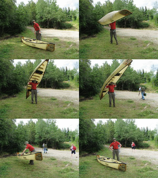
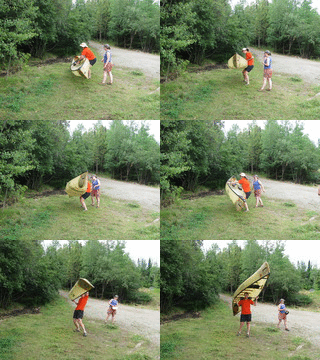
  • Finally, hoisting a canoe over your head for a portage is awesome. The key is to grunt while you do it.
Item Thumbnail Item Thumbnail

Friday, October 1, 2010

BWCA 2010: Day 5

Boundary Waters Adventure with Eric Z., Jessica H., and Kate S.
August 9-13, 2010


Day 5 - Back to Day 4

Thursday night was remarkably uncomfortable. The air was hot, humid, and dead calm - too hot to sleep. I also managed to make my bed on a set of rocks spaced at exactly the right intervals to render my ground pad completely useless. I didn't sleep well, but neither did Eric - I'm told that while I was asleep, I shifted far enough around the generously-sized tent to kick him repeatedly. Friday dawned cloudy and cooler, with a welcome breeze.

On our way out through the southeast arm of Wind Lake, we paddled past an area of storm damage from the Big Blowdown of July 4, 1999. This storm created an intense straight-line wind (up to 100 mph) called a derecho across a large area. According to the National Weather Service report, sixty people were injured by falling trees and other debris; twenty of those had to be evacuated by floatplane. Miraculously, no one was killed, but many portages were blocked, and people who were in the BWCA during the storm had considerable difficulty getting out.

Storm damage on Wind Lake

In fact, Kate was leading a group of high school girls on a BWCA trip when the storm hit. They didn't know the extent of the damage until later - of course, they had no way of knowing.

We made one last 175 rod portage from Wind Lake to Moose Lake. Powerboats are allowed on Moose, so to maximize our remaining wilderness time, we took a scenic detour around some islands away from the main channel. We noticed that vultures were circling nearby, but tried not to take that as an omen.

Portaging from Wind Lake to Moose Lake


We took out at the Moose Lake BWCA access (47.98893 N, 91.498210 W WGS84). We sat around for a while, waiting for our shuttle (Kate's mom), and eating our leftover gorp and Twizzlers. Yes, we carried Twizzlers around for five days. It was Jess and Kate's idea, and I'll defend their decision with all my strength.

One last portage up to the parking lot

With that, it was goodbye BWCA. We stopped for several hours at Kate's family friends' place on a lake just outside the wilderness area. These kind folks had a hot sauna ready for us; after several circuits of sweating in the sauna and jumping in the lake, I felt human again. We also had some fun goofing around the lake with a rowing shell (tippy as hell!), stand-up-paddle surfboard (weird at first, but fun!), and a bona fide lumberjack log-rolling competition log (really difficult to stand upon!). Then we returned the rental canoe to the outfitter, bought a six-pack of Dorothy Molter Root Beer, and headed to Kate's family's cabin for the night before we went home.